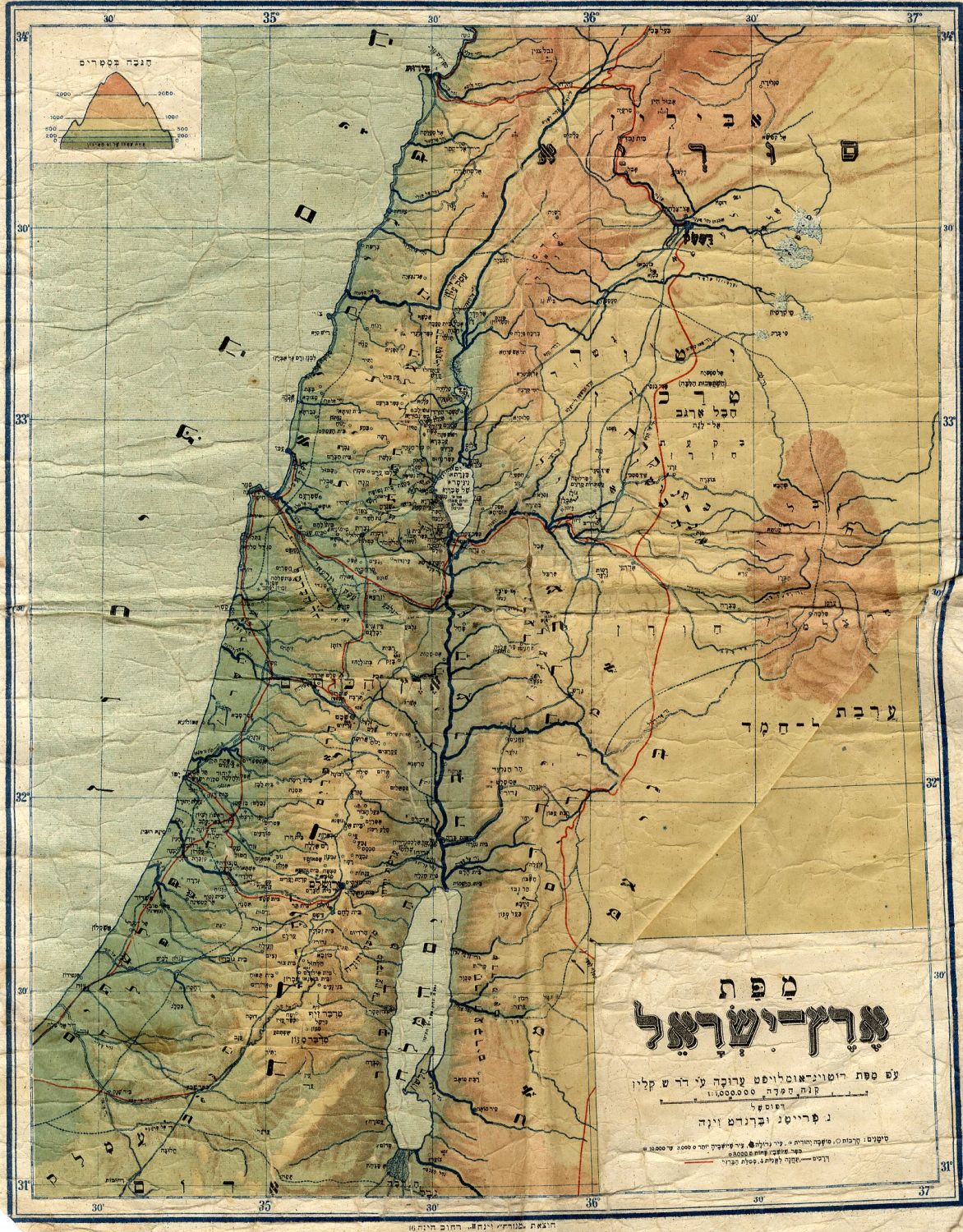
Large color map of the Land of Israel, marking various Jewish settlements and train tracks. Prepared by Dr. Sh. Klein, printed by N. Freitag and Brandt, c. early 20th century.
A similar map appears in Dr. Klein’s Eretz Yisrael , which was printed in Vienna, 1921, however this map is somewhat different.
31×39 cm.
Moderate condition. Wear and many creases. Aging stains. Fold marks. The map is affixed to an antique linen cloth.