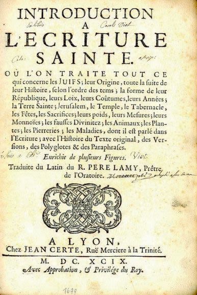

Introduction A Leeriture Sainte – preface to the holy scriptures – by Bernard Lamy. Lyon, 1699. Three sections. Maps, engravings.
[2], 8, [20], 423, [60] pages, 26 cm. French. Quality paper.
The book includes tens of large engravings of animals and trees mentioned in the Bible, in addition to folded leaves with the Holy Temple from different views, High Priest and the Temple vessels. Large, folded maps of the Holy Land and Jerusalem. The three maps are not listed by Laor.
1. Map of the Near East. 47×35 cm. In the bottom left corner: inset map of the Israelites’ travels in the desert. The lands of the Euphrates and Tigris in the right corner. The upper right corner features two sections of the globe. Not listed by Laor.
2. New map of the Holy Land – ‘in order to better understand the Bible’. 41×32 cm. Tribal divisions. Per the Roman version… In the upper corner: cartouche depicting the spies and a cluster of grapes. This map was made special and then enlarged for the French edition. By Mathieu Ogier. The map was printed in 1699, it is not listed by Laor.
3. Map of Jerusalem. Impressive, imaginary map. View from south to north, with the names of the sites, including the synagogues. This map isn’t either listed by Laor.
Original, nice leather binding with restored spine. Colored cut leaves. Minimal, aging stains. Very fine