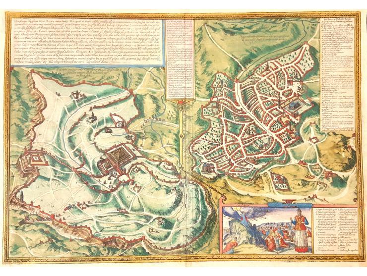
Hierosolyma, Clarissima totius orientis Civitas Iudaee Metropolis, copperplate engraving of the city. From two eras: The first century and the 16th century. Braun & Hogenberg. Koln, 1572. Early hand painting.
Latin. 48×34 cm. (The map measures 50×36 cm.). Quality thin, brown paper.From: Civitates Orbis Terrarum. Koln, 1752, volume I, pg. 53 – spread. First Latin edition, following Laicstain-De Jode. On the back, p. 52, Latin text.
Two eras of Jerusalem on one map: Jerusalem from the first century on the left, and modern 16th century Jerusalem on the right. A map key for each era.
Fold marks. Very fine condition.