Six maps which each depict the Mediterranean countries – the continent of Europe, Asia and North Africa. 17th and 18th centuries. Writing in Latin.
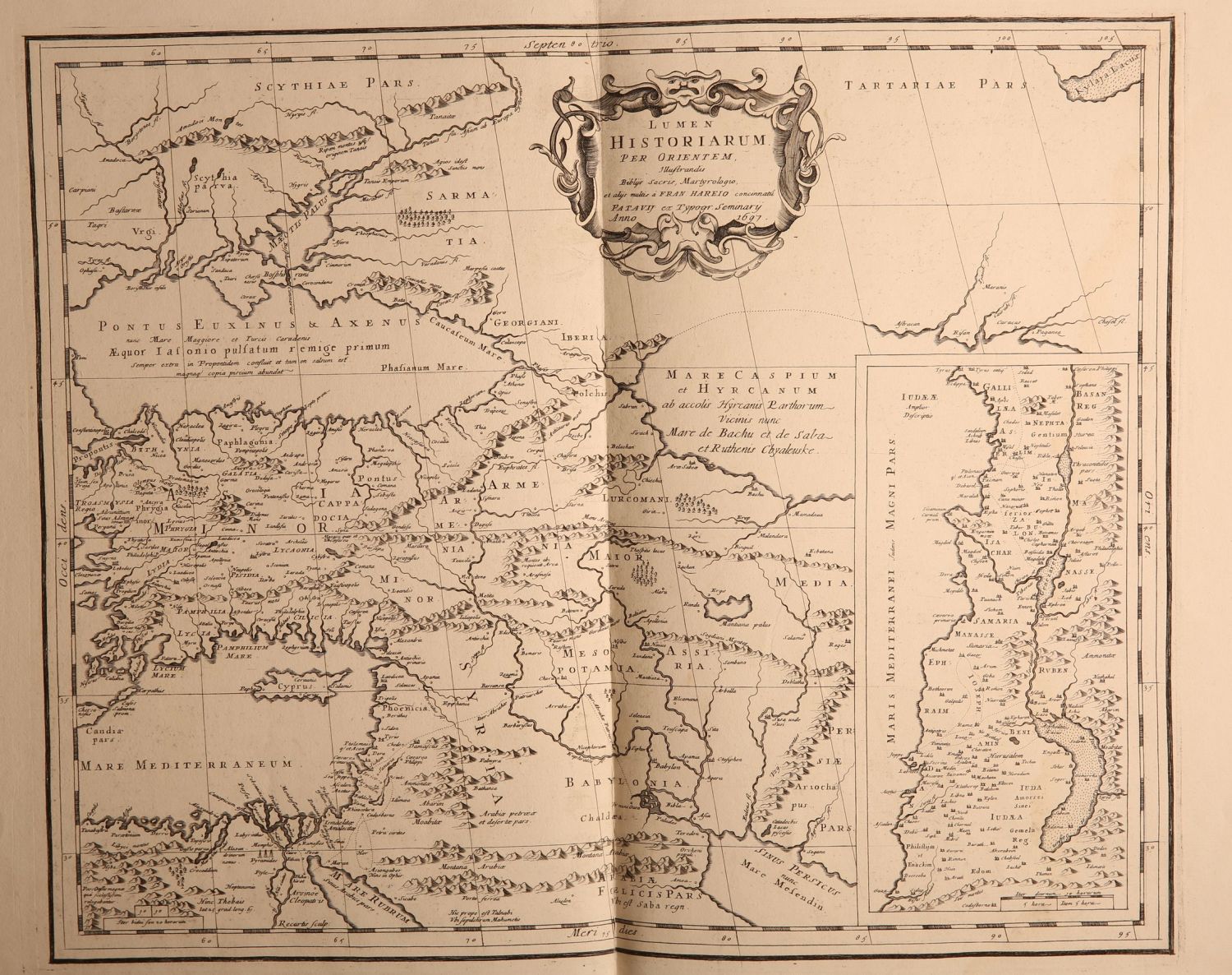
* LUMEN HISTORIARUM PER ORIENTEM a map which primarily depicts North Asia, the Land of Israel and a small section of Egypt. 1697.
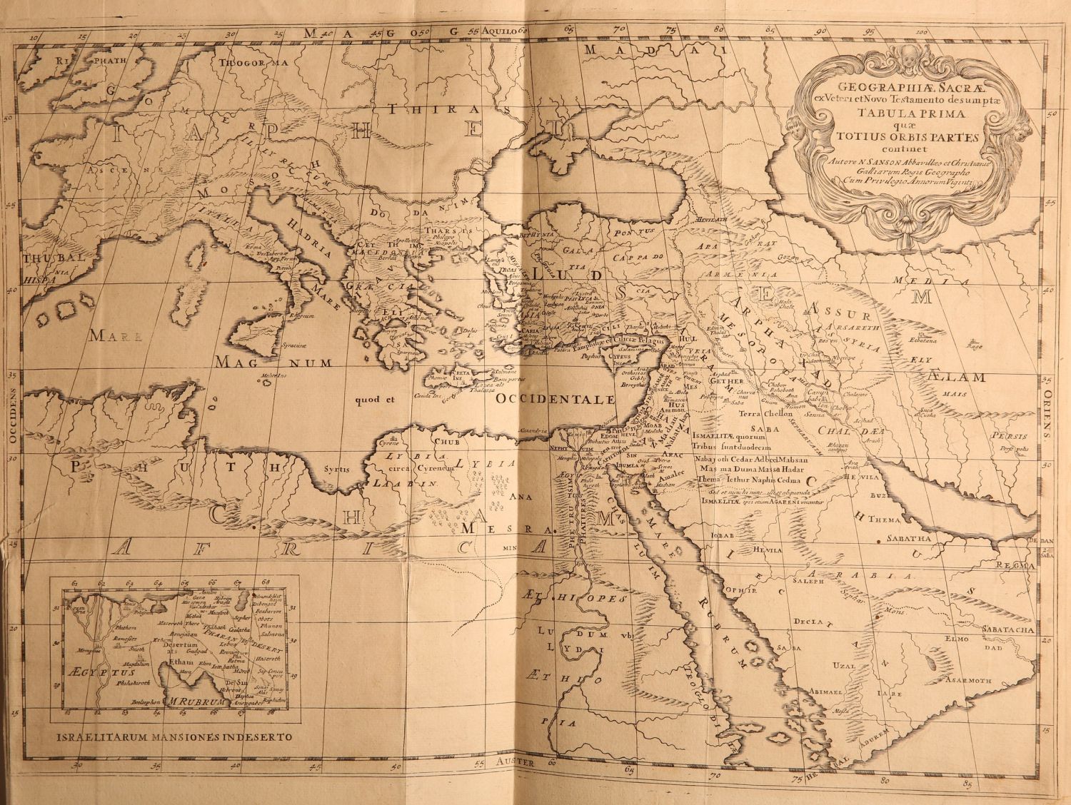
* GEOGRAPHIA SACRA …TABULA PRIMA QUOE TOTIUS ORBIS PARTES CONTINET – a map which depicts eastern Europe, the Land of Israel, the Arabian Peninsula and Egypt – the 18th century. Size: 55×41 cm.
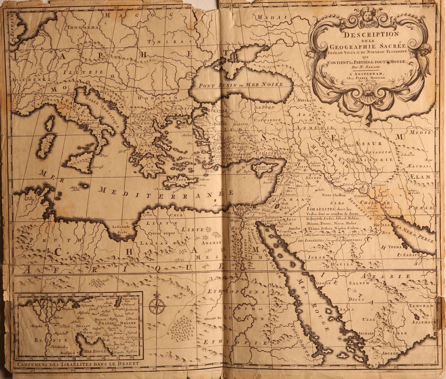
* DESCRIPTION DELA GEOGRAPHIE SACREE… CONTIENT LES PARTIES DE TOUT MONDE Amsterdam, 18th century. Size: 44×38 cm.
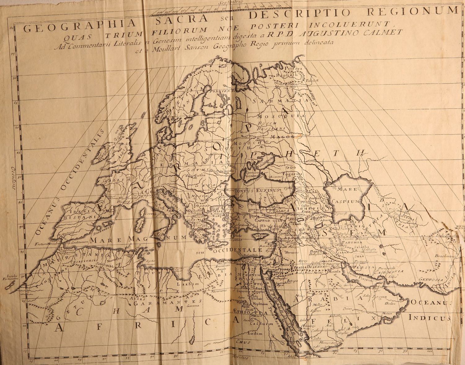
* GEOGRPHIA SACRA SET DESCRIPTIO REGIONUM QUAS RRIUM FILIORUM NOE POSTERI IN COLUERUNT… R.P.D. AUGUSTINO CALMENT – a map depicting North Africa, the Arabian Peninsula and North Africa. 18th century. Size: 44×57 cm.
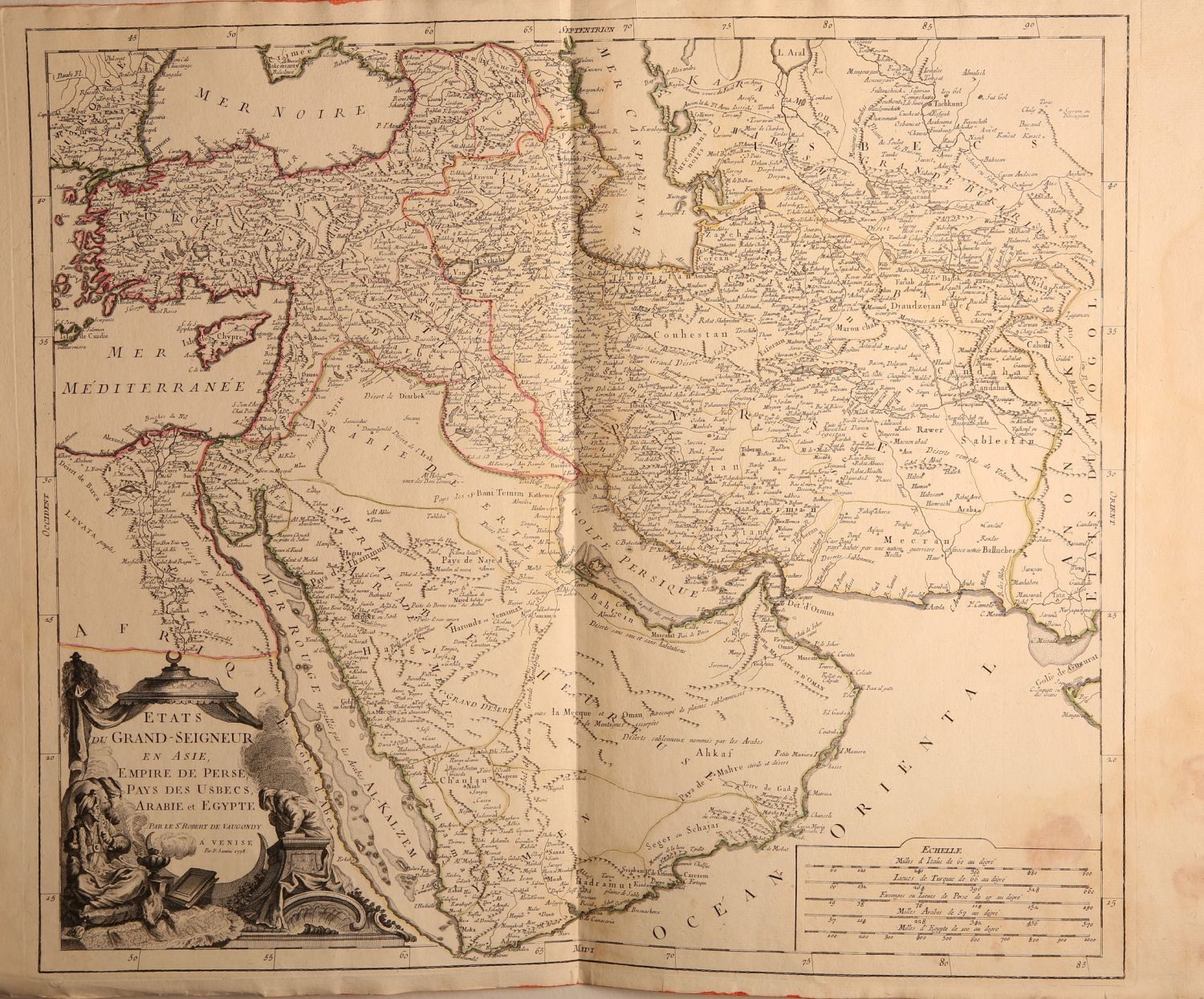
* ETATS DU GRAND- SEIGNEUR EN ASIA EMPIRE DE PERSE, PAY DES USBECS, ARABIE ET EGYPTE 1778. A map depicting the continent of Asia, Turkey, and the Arabian Peninsula. A pleasant cartouche on the bottom left. Size: 58×48 cm.
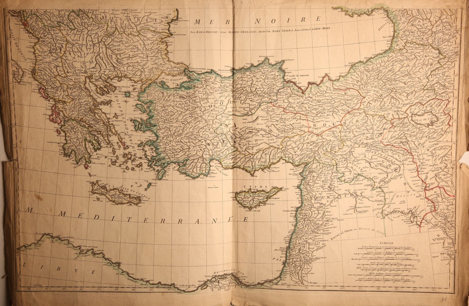
* A large map – an engraving colored by hand from the time of printing of Eastern Europe, the Black Sea, the Land of Israel and Cyprus. 18th century. Size: 80×50 cm.
Conditions vary. Some of the maps have small tears in the margins. Fine general condition.