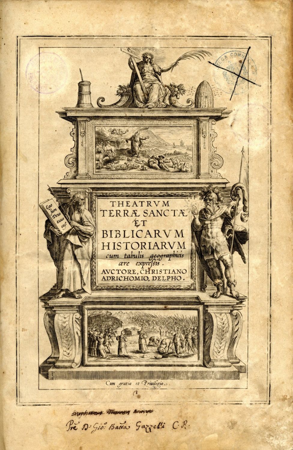
Theatrum Terrae Sanctae et Biblicarum Historiarum cum Tabulis Geographicu. Historic-geographic study of the Holy Land by Christian van Adrichom. Koln, 1600.
[6] leaves, 286 pages, [15] leaves. 36.5 cm. [12] maps. Latin.
The book is divided into chapters according to the tribes, with a map for each chapter. Separate chapter about Jerusalem. Chronology from Creation through 1585 – the year the author died.
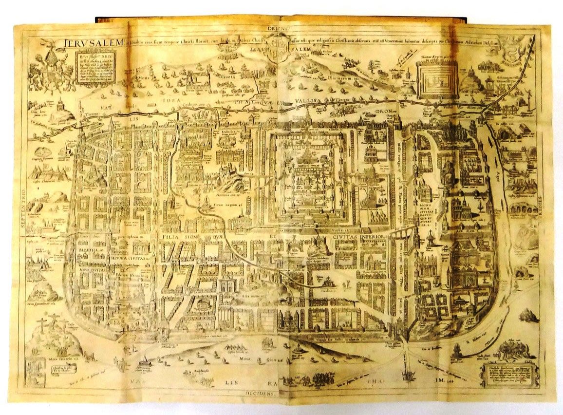
12 maps: Map of the Holy Land in its 12 tribal divisions; 10 maps of the tribes; map of Jerusalem. Copperplates. Some of the maps are folded, and are of various sizes; and some are spread across two pages. The first edition was printed in 1590, the second in 1593. This is the third edition. This is a very rare edition that is not listed by Laor and not in the National Library.
Map of the Holy Land in its 12 tribal divisions. View to the east. Shoreline from Sidon through Alexandria. Especially large map: 100×36 cm. Emblem of a snake with the name ‘Adrichom’ at the top.
Map of Jerusalem. Imaginary, schematic map from the era of the Second Temple. View to the east. Especially large map, 75×51 cm.
Christian van Adrichom (1585-1533) was a catholic priest who was born in Delft (Holland). He wrote a number of works about the Holy Land. This book is a comprehensive description of the Holy Land, with twelve maps. Six editions of the book were printed, the first in 1590. Adrichom’s maps and studies influenced all later cartographers. Adrichom used sources from his era that were lost over time, therefore this work is extremely important to the historic study of the Holy Land in the second half of the 16th century. As mentioned, the maps of this edition are not listed by Laor. However, Laor describes the maps of the first edition in numbers: 7-18 and 934.
The book is complete, including all the maps and indexes.
Magnificent leather binding with gold embossing. Minimal aging stains Small tears to the margins of the last 2 leaves (not from worms). Very few blemishes that have been professionally restored. Very fine condition.