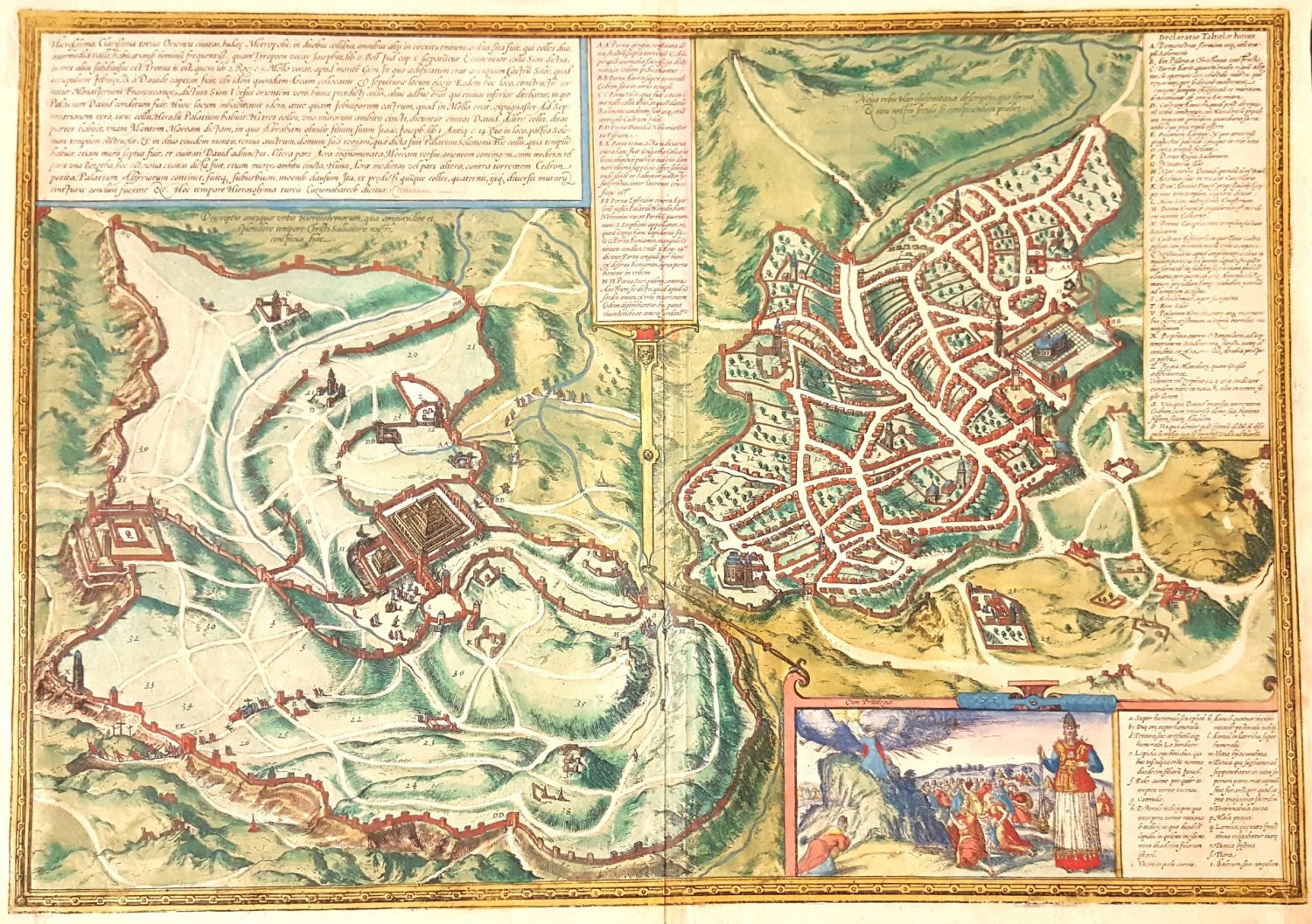
Hierosolyma, Clarissima totius orientis Civitas Iudaee Metropolis, a copperplate engraving of a map of the (‘Jewish’) city from two eras: the 1st and 16th centuries. Braun & Hogenberg. Klon, 1572. Early hand-painting. From Civitates Orbis Terrarum, volume 6 page 53, first Latin edition. One map depicting Jerusalem in two different eras, first century Jerusalem on the left and sixteenth century Jerusalem on the right. Each period has its own key. On the bottom right hand corner is a pleasant cartouche with a depiction of Moshe and the Tablets of the Covenant and the Jewish people at the foot of Mount Sinai, with Aharon in the priestly garments in the foreground. Dimensions: 50×36 cm. The engraving is pasted onto a stiff surface for display and protection. Slight tear on the bottom right corner, fine condition.