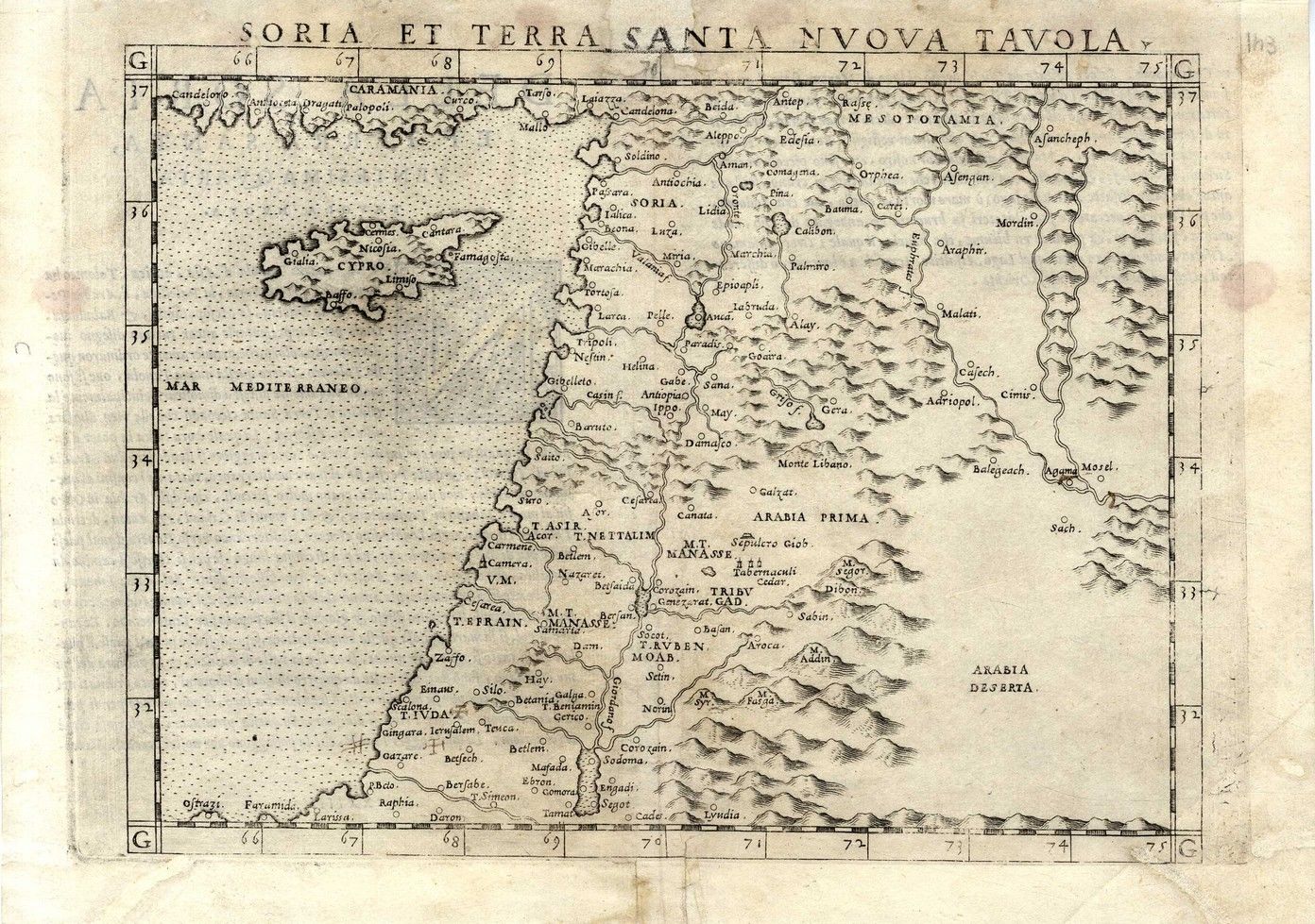


* Rtibvs Ephraim Beniamin Et, Dan. Ancient geographic map, according to the plots of Ephraim, Benjamin and Dan. Latin captions. 17th century. 40×49 cm. * Mare Magnum…Canaan under Filios. Israel. Geographic map of the Holy Land, in its tribal divisions. 18th century. 30×26 cm. * Soria et Terra Santa Nvova Tavola. Map of the Holy Land according to its tribal divisions. 18th century. 20×25 cm. * La Monarchie des Hebreux Sous Salomon ou le Roiaume Israel. Ancient geographic map of the Holy Land, according to the settlements in the time of King Solomon. Nice angel-shaped cartouched on the right. 18th century. 50×40 cm. * La Judee Palestine. Antiquated geographic map of Palestine, includes the Southern section through Egypt, Latin captions. 17th century, tribal divisons. 49×40 cm. * Small map of western Palestine, bordering the sea. 18th century. Latin. 20×16 cm. Varying conditions, generally very fine condition.