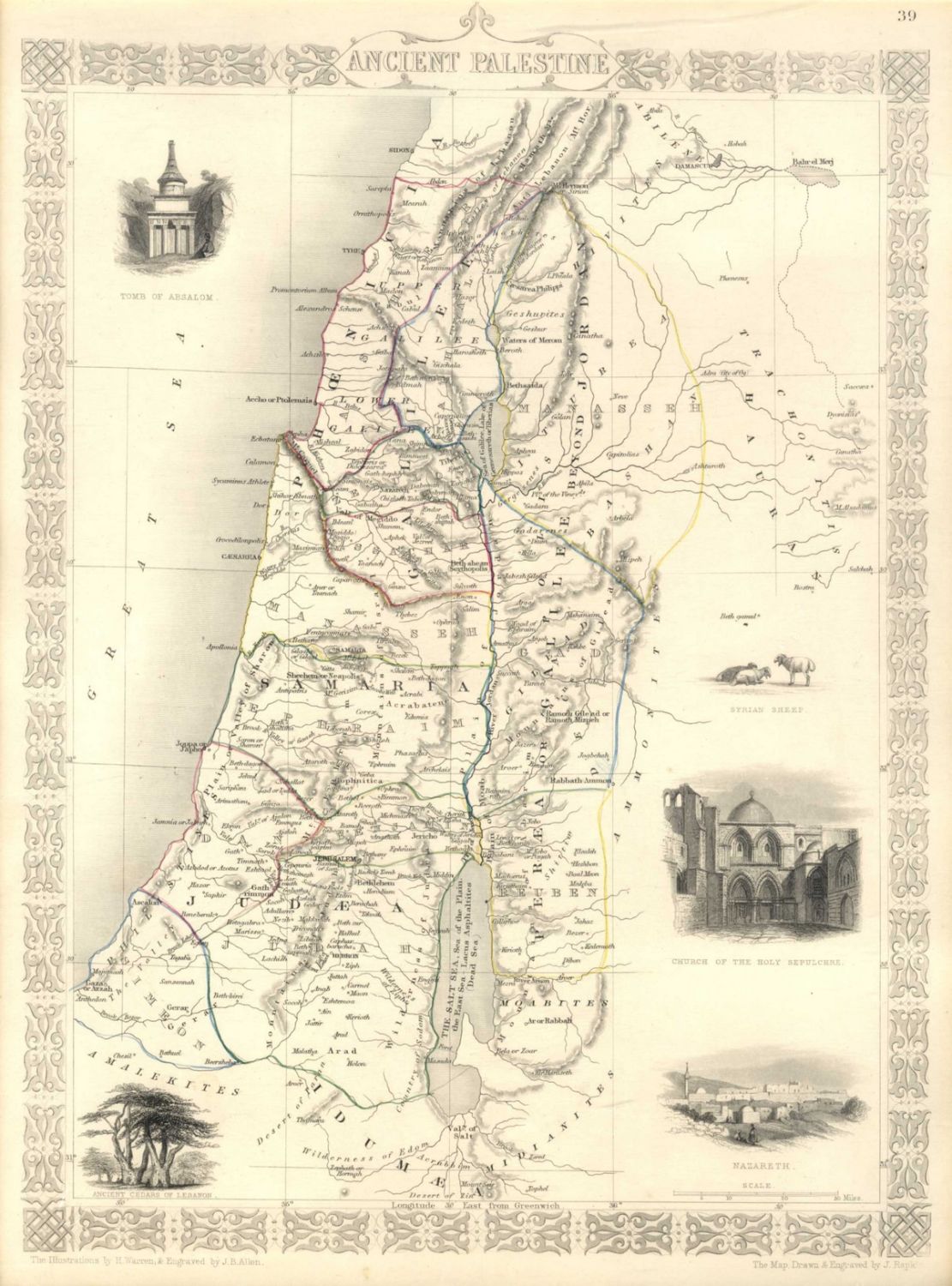


Various maps, all hand painted soon after they were printed: * Two colored maps of Jerusalem. One: Plan Von Jerusalem, 1836, depicting the Old City of Jerusalem and the Temple Mount. Two: Additional map printed in London, published by Longman & Co. Both were hand painted soon after they were printed. Seven large geographic maps of Palestine. Various publishers: * Colored geographic map of the tribal divisions, with French text. W. und C. Hoffmann, 1836. * Robinson Burckhardt Jacotin & Co, 1943. * Map of Canaan with nice cartouche of Absalom’s Tomb published by William Mackenzie. * Map of Palestine, 1843, published by Champan and Hall. * Large map of Palestine, Description geographique de la promise. * Elegant map of Palestine with a number of hand painted cartouches by J. Rapkin. Average size: 35×37 cm. The maps are mounted on to stiff surfaces. Very fine condition.