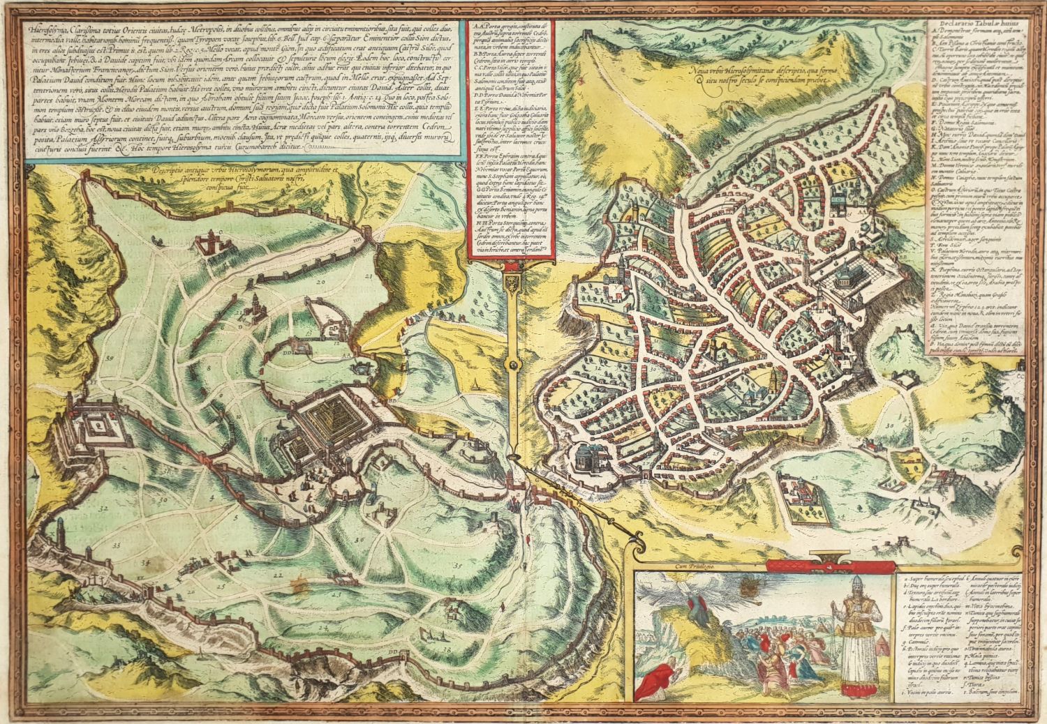
Hierosolyma, Clarissima totius orientis Civitas Iudaee Metropolis, copper engraving of a map of the (Jewish) city from two periods: the first century and the 16th century CE. Braun & Hogenberg. Cologne, 1572. Early hand-painted. From Civitates Orbis Terrarum volune 6, page 53, first Latim edition.
Copper engraving from Atlas of Cities of the World by Georg Braun and Franz Hogenberg which describes two periods of Jerusalem side by side. Jerusalem of the first century CE is on the left [‘Ancient Jerusalem’] and Jerusalem of the 16th century is on the right [‘Modern Jerusalem’]. Each period has its own legend. In the lower right corner is a pleasant cartouche showing Moshe receiving the tablets of the covenant with the children of Israel at the foot of Mount Sinai, and Aharon in priestly clothing in the front. Lior 1039.
Size: 37×51 cm.
Few stains on white margins. Folding mark in the middle. Fine condition.