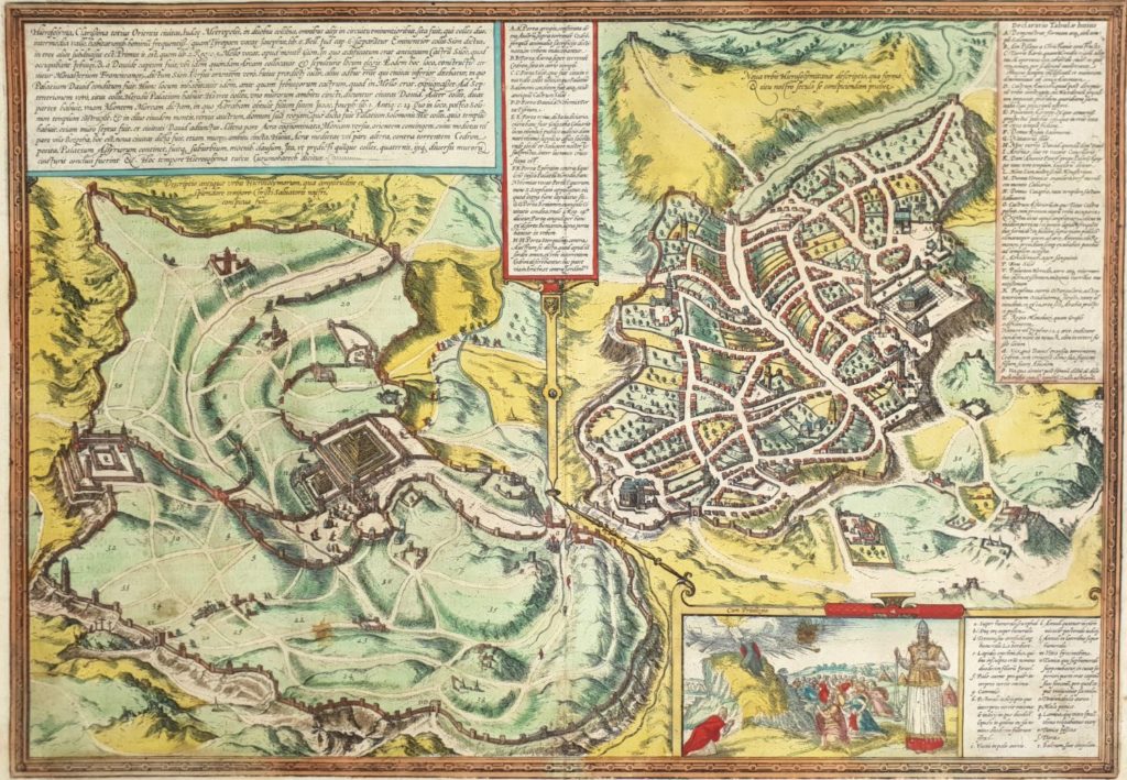
Hierosolyma, Clarissima totius orientis Civitas Iudaee Metropolis, copper engraving of a map of the (Jewish) city from two periods: the first century and the 16th century CE. Braun & Hogenberg. Cologne, 1572. Early hand-painted. From Civitates Orbis Terrarum volune 6, page 53, first Latim edition.
Copper engraving from Atlas of Cities of the World by Georg Braun and Franz Hogenberg which describes two periods of Jerusalem side by side. Jerusalem of the first century CE is on the left [‘Ancient Jerusalem’] and Jerusalem of the 16th century is on the right [‘Modern Jerusalem’]. Each period has its own legend. In the lower right corner is a pleasant cartouche showing Moshe receiving the tablets of the covenant with the children of Israel at the foot of Mount Sinai, and Aharon in priestly clothing in the front. Lior 1039.
Size: 37×51 cm.
Few stains on white margins. Folding mark in the middle. Fine condition.
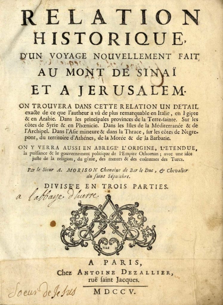
R elation historique d’un voyage nouvellement fait au mont Sinaï et à Jerusalem [ History of a Journey Newly Taken to Mount Sinai and Jerusalem ] by Antoine Morison. Toul, France, 1704.
Description of Morison’s pilgrimage to the Holy Land. His journey began in Egypt in 1697; in the second part, he describes his journey to the Holy Land and the life of Jews in Jerusalem. The third part describes his journey to Asia Minor, Istanbul and surroundings.
Copy without the portrait or the map. [22], 750, [9] pages. 24.5 cm.
There is a piece of paper pasted to the title page with the year detail 1705, but the copy before us is actually that of 1704. Original leather binding, several stains. Fine condition.
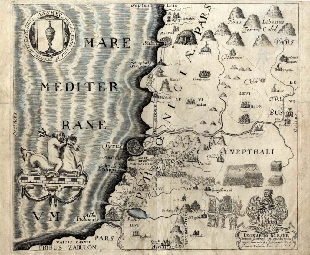
Eight maps depicting the journeys of the Children of Israel, the entrance into the Land and its tribal division – etches. Various etches, 18-19th centuries.
* The Forty Years of Travels of the Children of Israel out of Egypt through the Red Sea and the Wilderness into Canaan, or the Land of Promise – map of the Land of Israel from east to west including the Children of Israel’s route from Egypt to the Land of Israel. 28×48 cm.
* Nafthali – map depicting the tribe of Naftali’s portion with indications of the tribe of Levi’s location, partially hand-painted. 31×38 cm.
* Ephraim – map depicting the tribe of Ephraim’s portion integrated with various biblical scenes: the miracle of the splitting of the Jordan and the Children of Israel crossing it, Moshe on Mount Abarim, Elisha’s chariot and more. 31×36 cm.
* Confina Palestina Orientem – regional map of Ammon, Moab and Midian with indications of the tribal inheritances. 31×37 cm.
* Paradis Terrestre – map depicting the center of the Land of Israel with the tribal divisions. 42×47 cm.
* Map depicting the Gilad area, partially hand-painted. 36×32 cm.
* Map depicting the center of the Land of Israel, partially hand-painted. On the right, there is a nice cartouche of an angel riding a horse. 32×36 cm.
* Map depicting the Galilee area with the locations of the tribal inheritances. 30×36 cm.
Overall very fine condition.
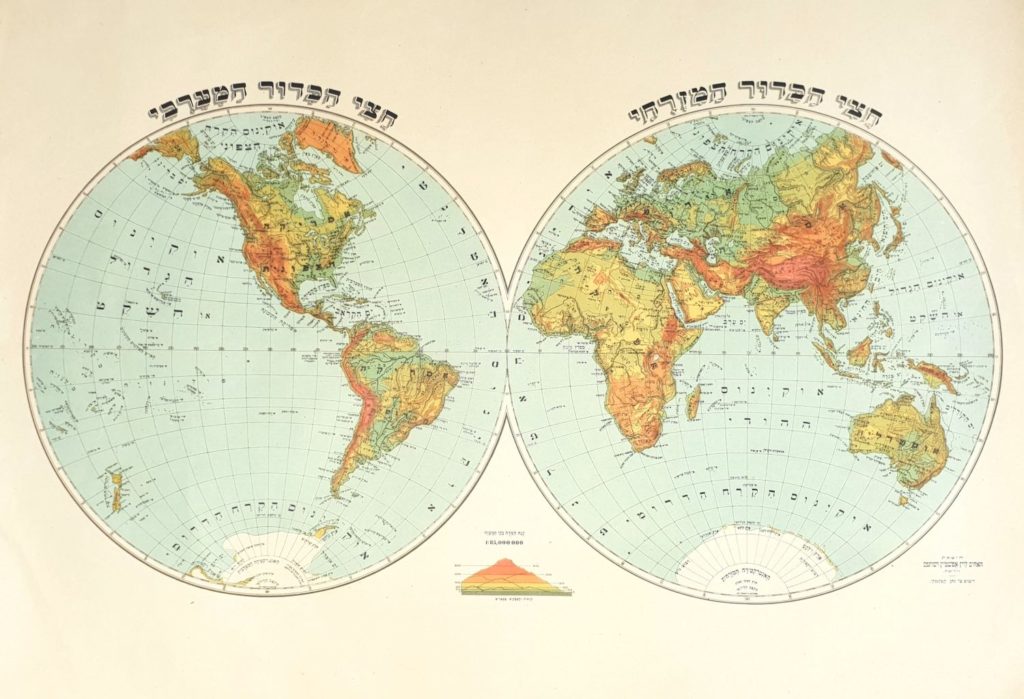
Large geographic map made by Natan Katlansky which depicts the ‘eastern half of the globe’ beside ‘the western half of the globe,’ published by the Levine Epstein Brothers and Partners. Warsaw, early 20th century.
Size: 43×58 cm. Very fine condition.
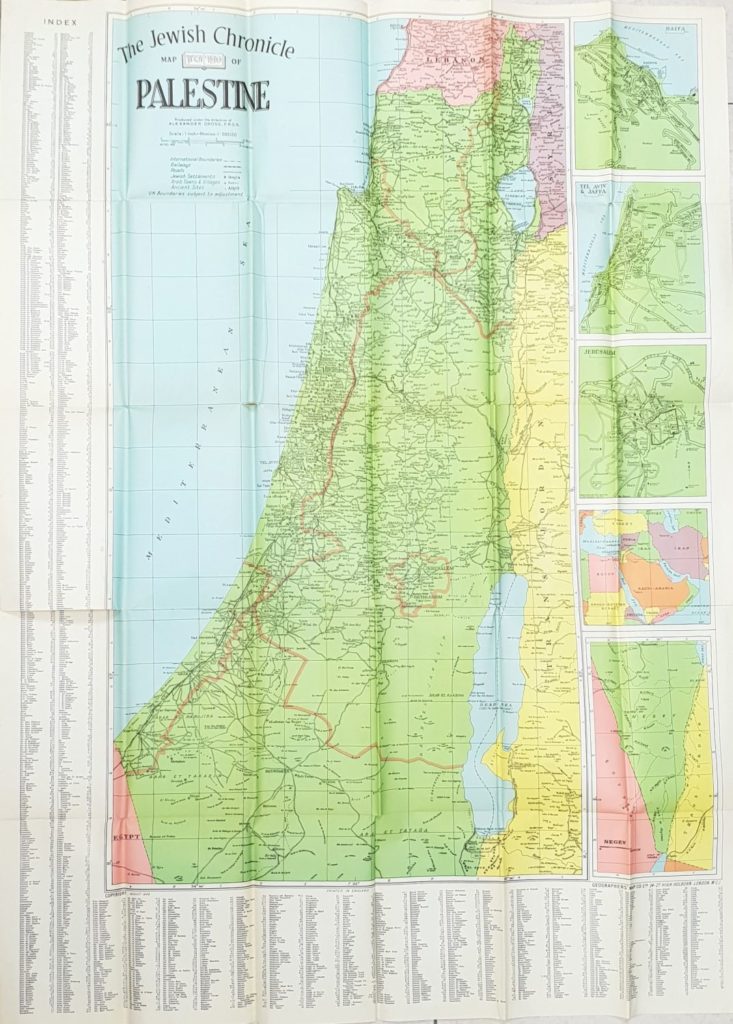
New map of Palestine showing the proposed U. N. boundaries of Israel -Jewish and Arab towns, villages and settlements, plans of Tel Aviv, Jerusalem and Haifa, index of place names – under the guidance of Alexander Gross, London, 1948.
Color map in lithograph print presenting U. N. boundaries proposed by the U. N.’s UNSCOP committee for the partition of Israel west of the Jordan river into two states – Jewish and Arab, and an international zone. The official name of the plan is ‘U. N. General Assembly Resolution 181’ which was passed by a majority vote at the U. N. General Assembly on November 29, 1947. The plan was accepted by the Jewish Agency, which functioned as the de facto government of the yishuv, and was rejected by the Arab leadership in the Land. The plan was not fully implemented in practice, but its acceptance paved the way for the end of the British Mandate and the establishment of the State of Israel.
Size: 100×74 cm. Fold marks. Fine condition.
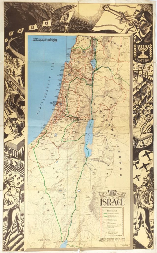
Geographic map of the Land of Israel in the third year of the State of Israel published by J. Szapiro. Impressive lithograph print illustrations of the young state’s accomplishments surround the map.
Size: 44×70 cm. Fold marks, slight tears. Fine condition.