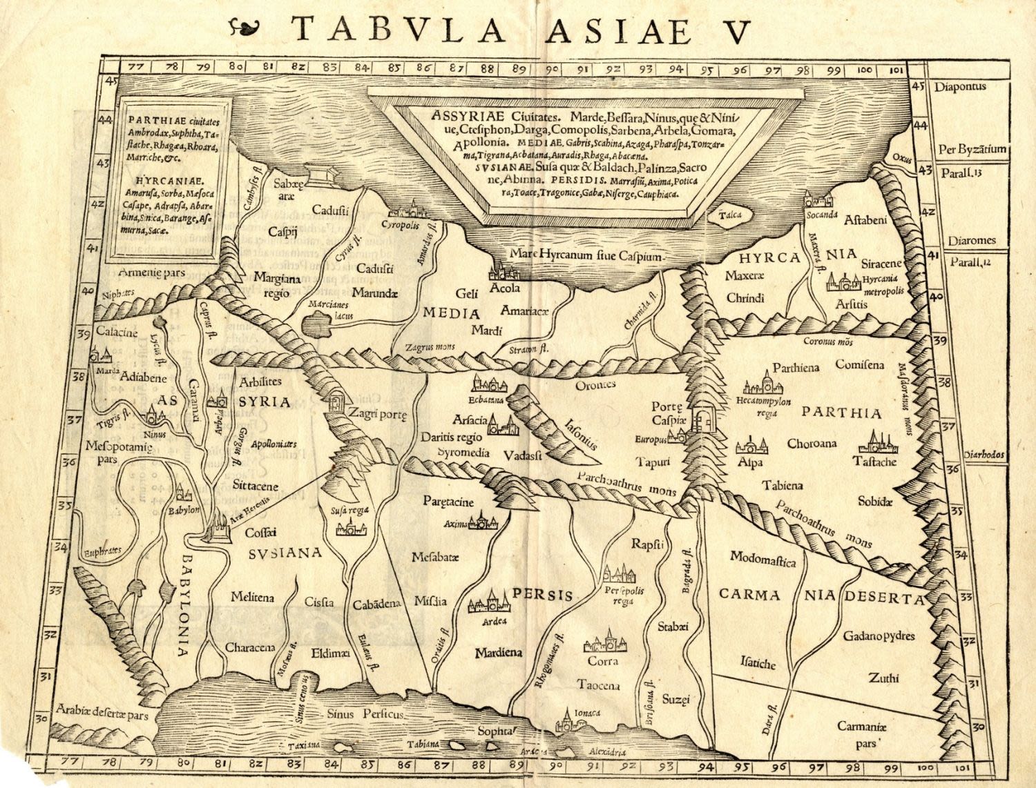
Tbula Asiae V. Map of the Near East from Mesopotamia and Babylon through Parthia and from the Persian Gulf through the Caspian Sea. Holy sites are marked. Woodcut shaped like a trapezoid. Black and white. On verso, p. 31, Latin text. By Sebastian Munster. From: Geographia Universalis, Vetus et Nova, complectens Claidii Prolemaei Alexandrini enarrationis libros VIII.. Basle, 1542, following p. 31.Latin. 34.3×31.6×25.2 cm. (leaf measures 28.6×28.8 cm.) Fine – very fine condition. Brown paper. Original fold. Tear with loss in the bottom left corner, with very slight blemish to the map border.