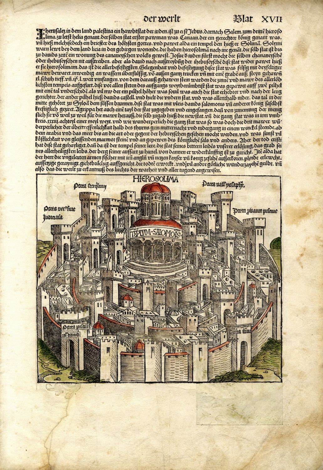
Imaginary map of walled Jerusalem. The Holy Temple and its environs. Circular city, as generally depicted in the Middle Ages. By Hartmann Schedel. Titled: Hierosolima. Nurnberg, 1493. Incunabula. Nice woodcut engraving. Black and white. Hand-painted in an early era.
[1] leaf, German text on the upper half of the page. 19×22.5 cm. (leaf measures 43.5×30.5 cm.).
From: Liber Chronicaurm: Das Buch der Croniken und Geschichten [Nuremberg Chronicle], p. xvii. German edition.
Printed only 40 years after the invention of the printing press and a year after the expulsion of Spanish Jewry and Columbus’ discovery of America. One of the earliest maps of Jerusalem known today.
Tear without loss, professionally restored. Fine condition.
Laor, 1123. Rubin, Jerusalem in Maps and Views, p. 60.