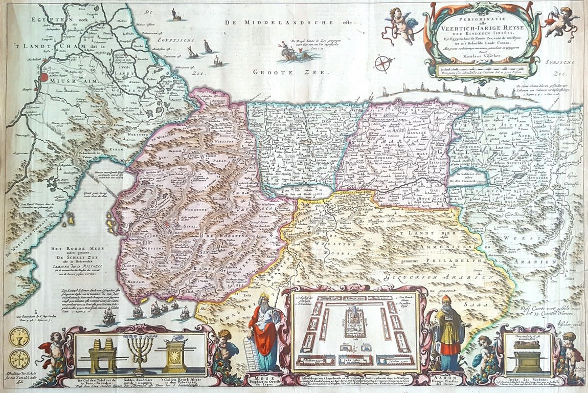
Veertich – Iarige Reyse der Kinderen Israels map of the Land of Israel according to the division of the tribal lands from east to west – engraving hand-painted at the time of printing, made by engraver Nicolaus Visscher Amsterdam 1660.
The map depicts the Land of Israel according to the division of the tribal lands. Images of Moshe and Aharon beside a diagram of the Holy Temple are at the bottom of the map. At right there is a pair of angels holding a picture of the Holy Ark and the cherubs, at left there is a pair of angels holding a picture of the Holy Temple’s menorah and the alters.
Size: 49×33 cm. The map is attached to a hard board for display and protection.
Very fine condition.