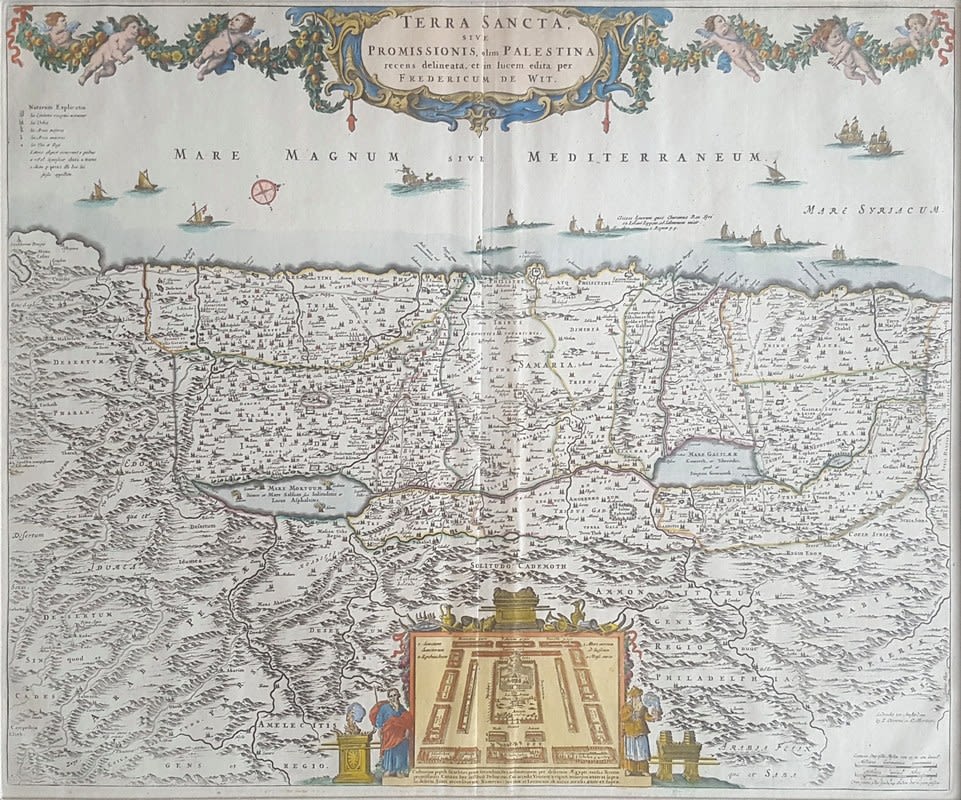
Terra Sancta Sive Promissionis Olim Palestina – engraving depicting the Land of Israel according to tribal divisions, hand-painted at the time of printing by I. Covens and C. Mortier, Amsterdam 17th – 18th century.
The map depicts the Land of Israel from east to west. Images of Moshe and Aharon are on the bottom, next to the gold alter and the copper alter. A diagram of the Holy Temple is between them. Images of putti holding a chain of leaves and flowers on the top. Latin writings.
Size: 55×45 cm. Placed in a magnificent passe-partout: 71×62 cm.
Very fine condition.